
01/02/2021 - Flooding Tewkesbury - 4.39m
- Feb 5, 2021
- 2 min read


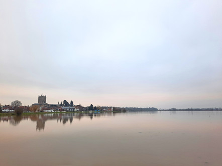


Just a few days after the previous peak, the water began rising again, this time even higher, up to a depth of 4.39m in the early hours of Monday 1st Feb at the Mythe Gauging Station. It is around 4.4m at this gauging station that things begin to get a little more serious here in Tewkesbury, with water starting to impose on major roads and properties, so we were right on the verge of it this time.
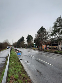
I have discovered that photos of flooded woods look quite nice/interesting, so I have been around taking pictures of the water-swamped trees around Lower Lode lane. There were only a few roads and carparks flooded, but most of the usual bunch did have a small amount of passable water encroaching on them, some of the normal hot spots were also closed altogether, closures which remain from the previous peak, as the water hasn't yet receded enough to open them up. The road outside Morrisons was also closed very briefly one night, but the next day was passable again, as in the photo above.
Silt Footprints:
An interesting thing I wanted to point out was the photo of the footprints left by my friend in the thick silt that had coated the path. It demonstrates perfectly just how much sediment deposition and transport actually occurs during flood events.
Extreme Surface Runoff:
A couple of days before the peak, I went for a walk around the fields here in Tewkesbury and was quite shocked by the extreme amount of surface runoff!
In this video you can see the water pouring out of the fields and into the river channel and also some whirlpools created by the river being sucked under a bridge.
I have been trying to get my head around how much water was flowing into the river channel from the fields, and I have a few theories:
1) The river flooded in the night and the level dropped quickly enough that the water in the fields hadn't caught up yet.
2) The river was spilling in the fields elsewhere and the fields were acting as a secondary river channel, transferring that water back to the main river channel further downstream.
3) Heavy rainfall mixed with very saturated fields with little vegetation coverage meant that water couldn't infiltrate into the ground, and flowed in vast quantities over it.
Having looked at the footage and thought about it all, my current preference sits with my third theory, and that the incredibly saturated ground was responsible for it, and it therefore was genuine surface runoff.
Light Snowfall:
The day before the peak, we were blessed with some more snow, which was very light but added to the atmosphere nonetheless:
Strong Currents on the Ham:
And finally on the day of the peak I went to the far end of Severn Ham where the water was flowing onto the ham from the Warwickshire Avon's channel, although I suspect that a lot of it was actually from the Severn. The flow was quite rapid:


Comments